
|
GeorgevilleHistoricalSociety/Societ d'histoire de Georgeville
|
|||||||||||
Prints Before the introduction and evolution of photography, the representation of landscape was manifested by various art forms such as paintings, sketches and engravings. With respect to the latter, two notable artists, one world-renowned, the other locally recognized, featured both the village of Georgeville as well as Lake Memphremagog among their repertoire of subject matter. The two, William Henry Bartlett (1809-1854) and William S. Hunter Jr. (1823-1894) created sketches from which steel or wood engravings relating to the village and lake were made during the middle decades of the nineteenth century.
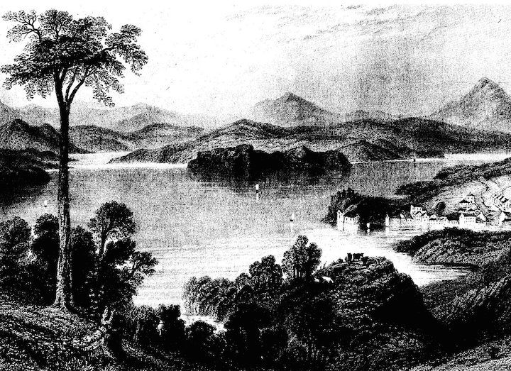
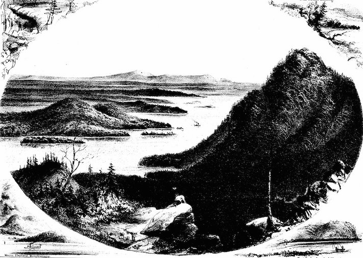
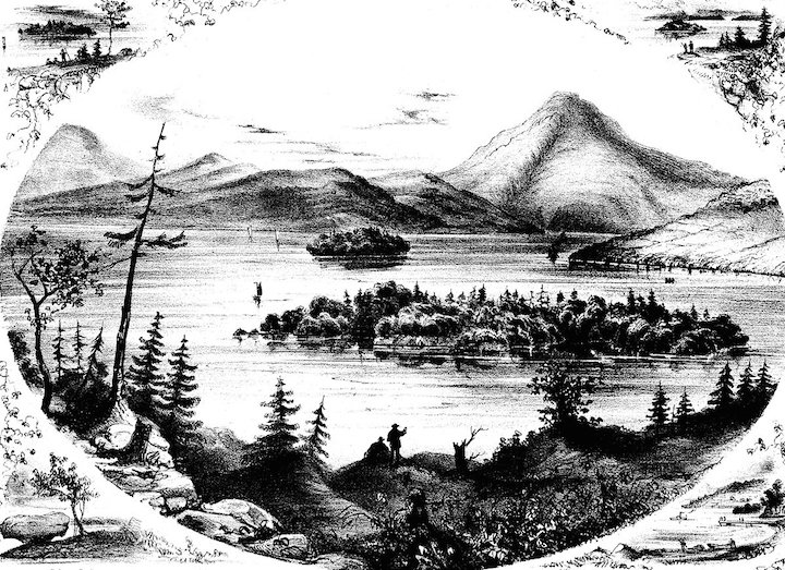
In one of his four visits to North America, the English artist W.H. Bartlett travelled throughout Canada, including a stopover in Georgeville. While visiting the village, he made a number of drawings from which engravings were later fabricated. These representations of the village were entitled Georgeville, Copps Ferry (near Georgeville) and Lake Memphremagog (near Georgeville). As the latter implies, Bartlett also focused on images of the lake, notably sections that included Stanstead Township to the south of the village, that is, the municipal jurisdiction wherein the village was and still is, located. In later years many prints were made from these engravings which were initially published in 1842 in Willis Canadian scenery illustrated. From an artistic perspective, Bartletts drawings were a fine example of artistic license, as his portrayal of the physical landscape may best be described as a form of exaggeration His representation of the Appalachian Mountains in the sketches of the village and the lake, for example, were more reflective of the European Alps than the mountains bordering Lake Memphremagog. With respect to the following prints, note that Copp's Ferry and Sugar Loaf were the original names for Georgeville and Mount Elephantis, respectively. Original titles were retained, with the words in parenthesis those of the artists, those in brackets added for clarity. 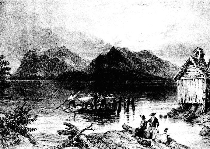
Copp's Ferry (near Georgeville)
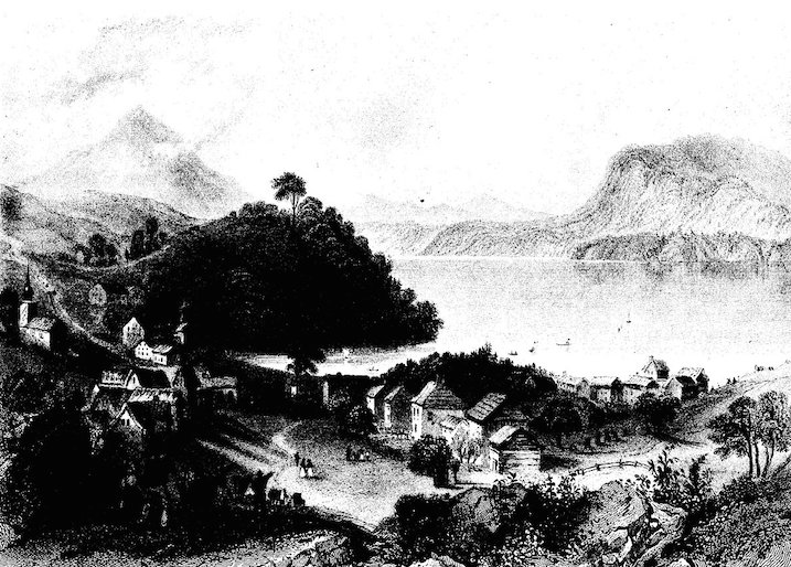
Georgeville (view to the south from a point north of the village)
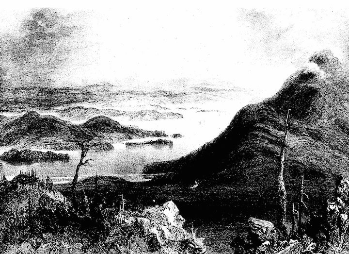
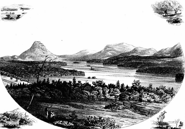
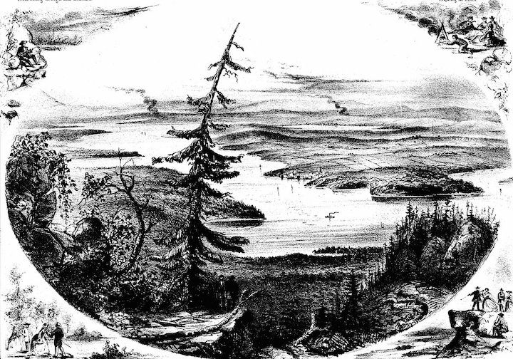
View Across the Boundary Line (from Sugar Loaf) W.H. Hunter A somewhat later contemporary of Bartlett was the Stanstead-based artist W. S. Hunter. Admittedly influenced by the work of Bartlett, Hunter produced a number of etchings based on sketches taken from the same view point as his English predecessor. To this extent, he embraced the same appreciation for the areas natural beauty. In comparison, however, Hunters drawings were more realistic representations of the landscape than Bartletts tendency towards exaggeration. His drawings and subsequent engravings and prints, were enhanced with the addition of vignettes of related scenes which appeared in each corner. Hunters notoriety as an artist sprang from his self-published collection of engravings entitled Hunters Eastern Townships Scenery which he released in 1860. Like Bartlett, his subject matter was not restricted to Lake Memphremagog, neither the communities around it.
Lake Memphremagog- looking southeast from the Outlet (Magog)
View of Owls Head from Sugar Loaf Mountain looking South
View from Sugar Loaf looking north, Lake Memphremagog
Owl's Head, Round Island, Whet Stone Island and Magoon Point
Besides Bartlett and Hunter, there were other print makers who capitalized on the local scenery associated with the lake. One of these, well known to many North Americans, was the firm of Currier & Ives. In 1860, the company released a lithograph version of one of Bartletts etchings that encompassed the view of Owls Head taken from the southern side of Fitch Bay, with Whetstone Island and Hell Gate in the foreground and Magoon Point further back. Although not an exact copy, the lithograph nevertheless illustrated the basic elements of the landscape portrayed by Bartlett. The appeal of the scene in question was confirmed when Hunter issued his own version in his 1860 publication. Currier & Ives did not limit its interest in Lake Memphremagog to this one particular scene, as it similarly copied another Bartlett print of The Outlet, subsequently renamed as Magog. 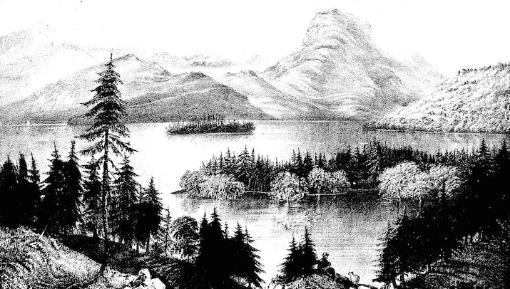
Currier & Ives: View of Lake Memphremagog and Owl's Head
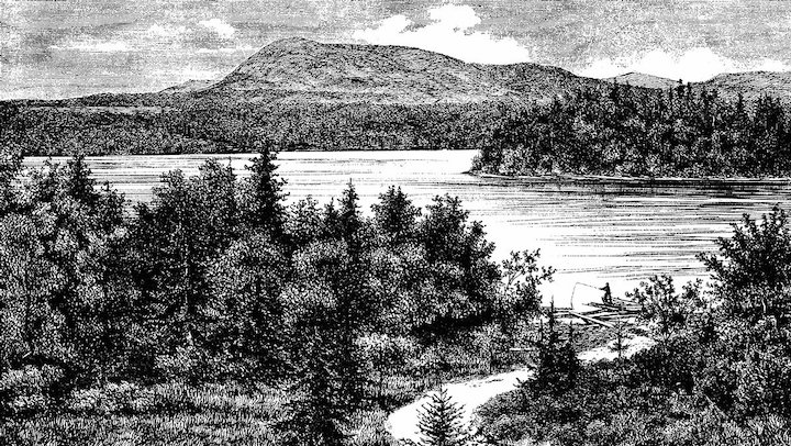
Canadian Illustrated News Another source of prints portraying the local landscape was the Canadian Illustrated News which was published out of Montreal from 1869 to 1883. The weekly magazine, complete with a French language counterpart, was the first publication to produce photographs consistently. It took advantage of the invention of half-tone photoengraving which was an advancement over the older steel engraving employed earlier by Bartlett and others. The process involved the use of wood engravings, prepared by different artists who were at times credited for their talent. In the case of two Georgeville prints, the engraver was identified as Eugene Haberer. Based in Quebec, it was not uncommon for the weekly to include images of the more scenic parts of the province, not the least of which was Lake Memphremagog and its environs. And as in the example of Currier & Ives, the News was not above relying on the works of others. In the case of the publications two Georgeville prints, the works of Hunter were copied.
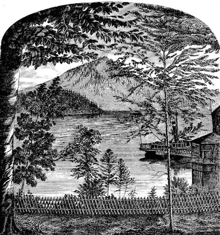
View of Mount Elephantis from Fern Hill(the Molson estate)
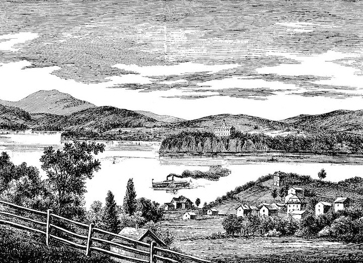
Georgeville, P.Q. from a point south of the village, looking north
Georgeville from the hill, looking across the lake to Gibraltar Point and Bolton Cliffs on the west side
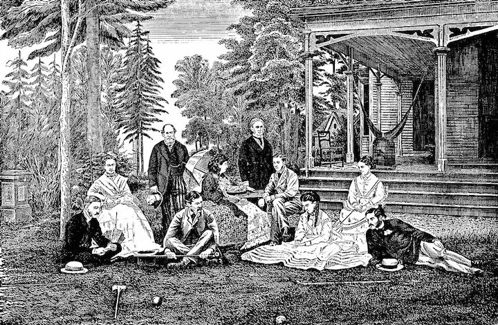
View from Belmere (the Allan estate]
A Distinguished Party at Belmere.In attendance was HRH Prince Arthur.
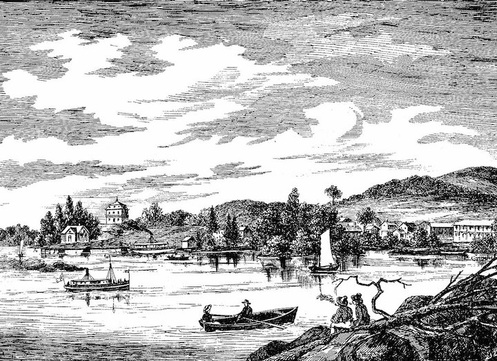
Belden and Co. In addition to the artists, engravers and/or publications mentioned, there were other sources where one can find prints of the village or surrounding countryside. A case in point is the Illustrated Atlas of the Eastern Townships and South Western Quebec published H. Belden and Co., 1881. Within this atlas appeared a print of the Camperdown-House and Res. of W.E. Tuck, Esq, one of many such representations of county notables that were documented. Apart from depicting the residences of what were likely subscribers to the publication, the atlas also contained valuable prints of county maps which illustrated the grid outline of ranges and lots of individual townships. 
The Camperdown House, residence of W.E. Tuck Esq., Village of Georgeville
|